The River Thames
in Flood
Windsor, December
2000
Last updated -
Friday 15th December 2000
This article contains 18 photographs.
Please allow time for them to arrive!
All text
and photographs copyright © ThamesLink Ltd 2000
Click here for details of
the Environment Agency Flood Warning system
Click for November
flood photographs
Index
to River Thames stories
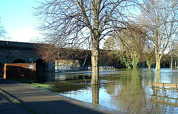
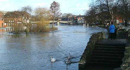 Towards Windsor
Bridge from upstream (13th December)
Towards Windsor
Bridge from upstream (13th December)
13th December 2000
Just over one month ago
in the first week of November the UK was suffering some of the
worst and most widespread flooding for 50 years or more. Yorkshire
was suffering, the Severn Valley was inundated as well as many
parts of Kent and Sussex. The Midlands were not spared either.
Yet here in Windsor, although the river was high, and even though
some properties in Maidenhead were affected in the Ray Mead Road
area, no inundation occurred in this area.
One month later and the
river is in flood once more. It is true to say that the river
level had not actually returned to normal at any time in the
last four weeks but at least the river's height was contained
within its banks. Now the river has burst its banks once again
and river levels forecast to continue rising for the next few
days.
This week river levels
are higher than November by some 6" or so. The following
photographs were taken in the course of this week and will be
added to in the event that the river rises significantly. No
threat to housing exists in the Windsor area at this time.
15th December 2000
The river has risen 2"-3"
in the last two days, and is now approximatelky 3 feet above
normal, sufficient to flood The Brocas on the north side of the
Thames although roads and property in the area remain above the
river level.
Experts are predicting
that, with the ground saturated, severe weather at any time through
the winter could well cause a reoccurrence of increased river
levels from time to time. The severity of the rainfall, and the
intervals between each period of bad weather, is obviously critical
to the potential for future flooding.
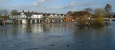 Eton College Boathouses
(13th December)
Eton College Boathouses
(13th December)
 From The Promenade
at Barry Avenue.
From The Promenade
at Barry Avenue.
Baths Island is now totally submerged and The Brocas,
on the far side of the river, starts to flood. (13th December)
 Two days later,
15th December, and The Brocas on the far side of the river is
inundated.
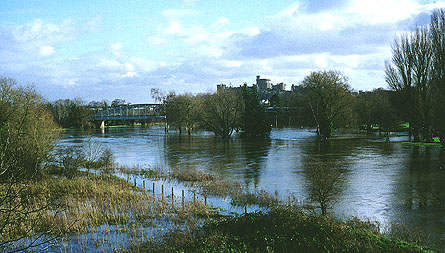
View
this area from the other side of the river, 14th December 2000
View
the same scene in 9th November 2000
Two days later,
15th December, and The Brocas on the far side of the river is
inundated.
View
this area from the other side of the river, 14th December 2000
View
the same scene in 9th November 2000
 View from The Promenade
(13th December)
View from The Promenade
(13th December)
The water begins to flood The Brocas.
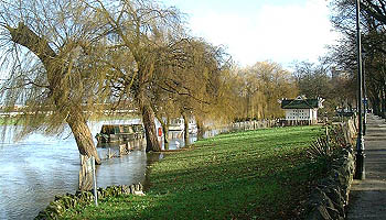 The Promenade at
Barry Avenue. (13th December)
The Promenade at
Barry Avenue. (13th December)
The boats remain moored alongside the towpath beside the river,
now under almost two feet of water.
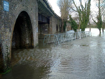 The Footbridge
to Baths Island. (13th December)
The Footbridge
to Baths Island. (13th December)
Water streams through the Great Western Railway arches.
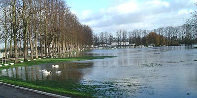
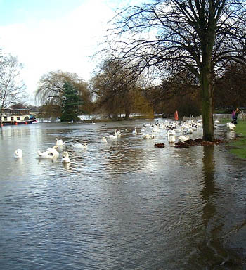 The view downstream
from The Great Western Railways arches.
The view downstream
from The Great Western Railways arches.
And a fine flock of swans. (13th December)
 Two days later
and the river has risen by some 4" inches.
Two days later
and the river has risen by some 4" inches.
(15th December 2000)
 Upstream from Brunel's
'Bowstring' Bridge, the flood water has covered Baths Island.
Upstream from Brunel's
'Bowstring' Bridge, the flood water has covered Baths Island.
(14th December 2000)
[Click to see a summer view]
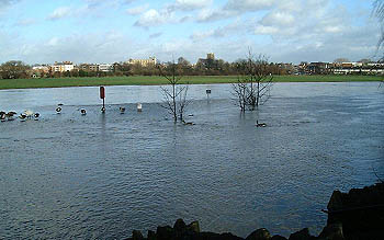
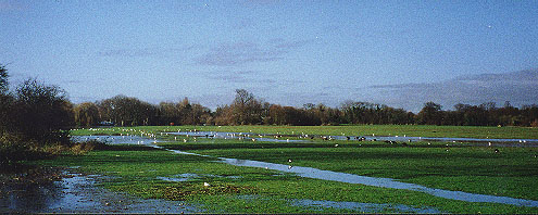
Some views of
Windsor Racecourse
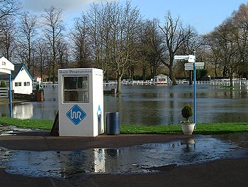
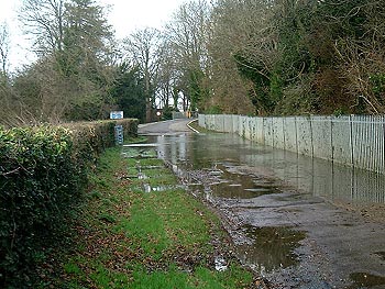 The approach road
to Windsor Racecourse flooded
The approach road
to Windsor Racecourse flooded
on the approach to the bridge. (13th December)
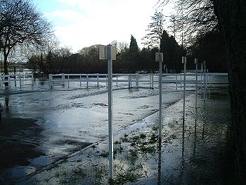
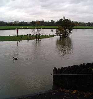
 The car park at
Windsor Racecourse flooded. (13th December)
The car park at
Windsor Racecourse flooded. (13th December)
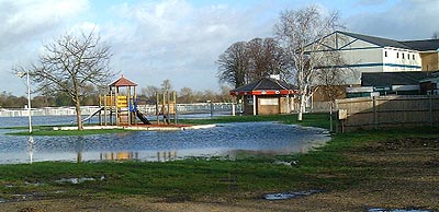 The grandstand
and play area, with the race course beyond
The grandstand
and play area, with the race course beyond
under several inches of water. (13th December)
 Officials parking
area adjacent to the river. (13th December)
Officials parking
area adjacent to the river. (13th December)
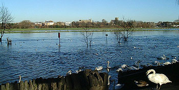
 Windsor Racecourse.
(13th December)
Windsor Racecourse.
(13th December)
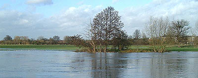
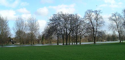
The Home Park
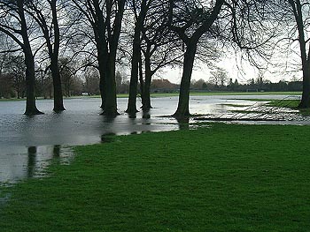 Above and Below:
The river encroaches
onto the eastern side of The Home Park, Windsor.
The river at this point is downstream of Romney Lock. (13th December)
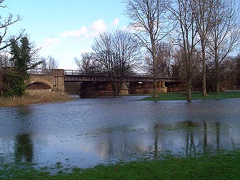 The Railway Bridge
- Home Park, Windsor. (13th December)
The Railway Bridge
- Home Park, Windsor. (13th December)
There had been a minor
flood in December, but nothing much except that the ground was
becoming saturated, and the snow represented whole lakes of water
if there was a sudden thaw. And there was. In addition, heavy
rain fell on March 10th, followed by even heavier rain - nearly
one inch (2.5 cm). On March 14th the thawing snows could not
drain into the frozen ground and so the water continued down
hill into the streams and rivers. These rose at an alarming rate
- sometimes almost a foot (30 cm) an hour. Old hands prepared
to visit relatives living on high ground. The Thames topped its
banks on 14th March...
Further reading
Click here for details of
the Environment Agency Flood Warning system
Click for November
flood photographs
Index
to River Thames stories
Back
to What's New
Back to Royal Windsor Home Page
|

![[Click to see a summer view]](../windsor/info/images/lscslrvr.jpg)