|
||||||
|
||||||
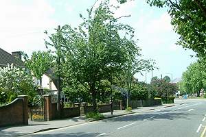
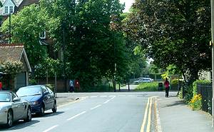
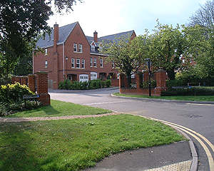
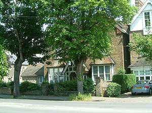
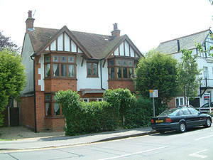
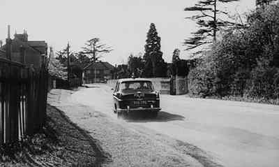
Alma Road
|
|
|
|
|
|
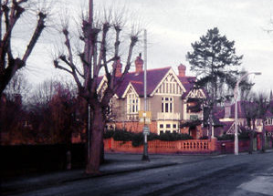
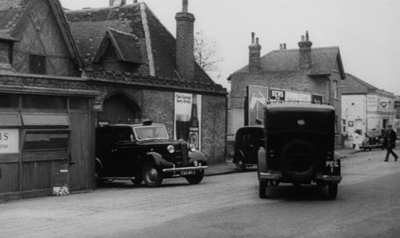
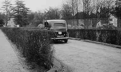
The Frogmore Hotel in Alma Road |
 |
|
 |
|
|
  |
 |
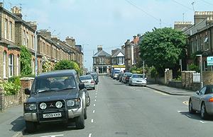
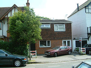
Arthur Road
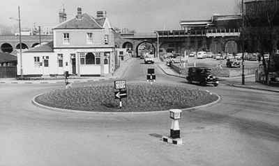
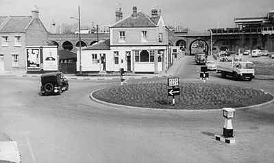
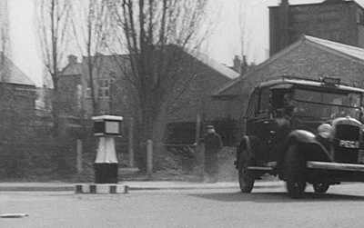
This area has changed a great deal since 1963. The gas works has gone, as has the Noah's Ark PH and King Edward Court has been constructed on the right between the roundabout, the railway arches and Peascod Street, Some of the early Victorian terraced houses still survive however. |
 |
|
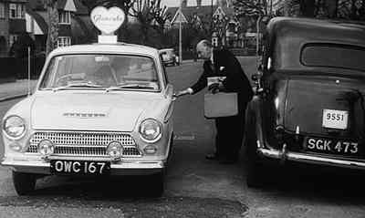
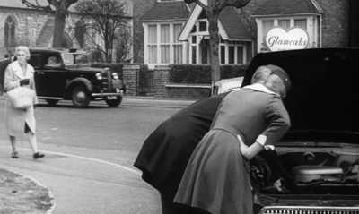
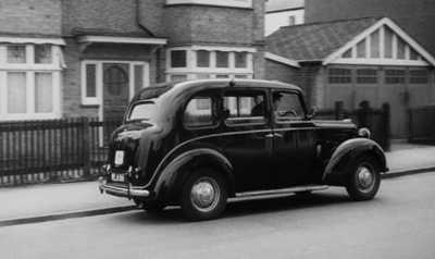
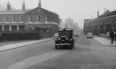
In this view, the road off the roundabout beside the taxi, led to 'Breakneck Alley' or Goswell Hill, which exists to this day alongside the arches, leading up to Windsor Central Station (Windsor Royal Station). |
 |
|
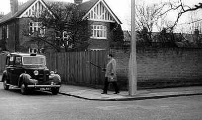
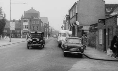
Bexley Street
Traffic lights were set up at the junction of Bexley Street and Alma Road. The wooden base board supporting the pole is clearly visible in the picture R > |
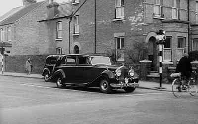 Sid James in his taxi sneaks up the inside of a 'posh' Rolls Royce. After some banter, the lights change and Sid James hares around to the right in front of the Rolls. See Alma Road above. |
|
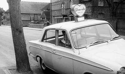
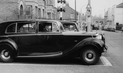
Bexley Street and Alma Road junction looking north with Ward Royal on the right. |
 In the screen shot above it is possible to catch a glimpse of the Clarence Hotel, on the corner of Alma Road and Oxford Road to the right of this picture. The present Copper Horse PH was built on the site when Ward Royal was built in 1968-69 This side of The Clarence Hotel was a stone masons yard with a display of headstones. |
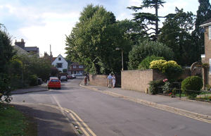
Claremont Road
The pathway to the west of Alma Road, at the junction with Claremont Road. Forty years on and the trees are much more mature. |
 |
Clewer Court Road
|
 Clewer Court Road looking west with Clewer Church on the right. Windsor-Slough Relief Road runs directly behind the camera now. |
|
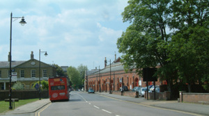
Datchet Road
There has been many changes in this part of Windsor. Backstage at the Theatre Royal has been rebuilt to provide more scenery storage and dressing rooms, new offices have been constructed between the camera and the Theatre Royal on the corner of Thames Street, and Windsor Glass, on the right, was demolished and redeveloped along with the whole of the Farm Yard. |
 |
|
In comparison with the area opposite Windsor Station, this area is changed little. |
 |
|
Farm YardOpposite the Riverside Railway Station |
|
|
 |
 |
|
 |
 |
|
Edward VII Hospital
This was the entrance to Edward VII Hospital from Bolton Avenue. In 2002-3 this land was sold for development. At the same time major alterations were carried out at the hospital behind the original buildings. |
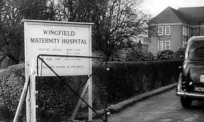 Here Sid James's taxi enters the grounds of Edward VII Hospital taking in a young couple who are convinced their baby is 'on the way'. It is of course one of several false alarms and so we see the taxi arriving and departing several times! |
|
These 1930s style buildings to the rear of Edward VII Hospital were nurses' residential units and were demolished to make way for the prestige housing development of 2002-3
There is more about the King Edward VII Hospital in Windsor here. |
 |
|
 |
||
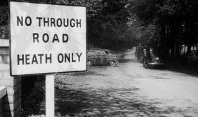
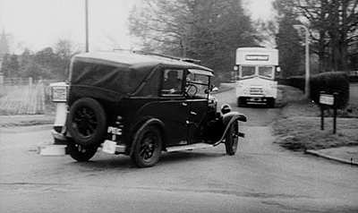
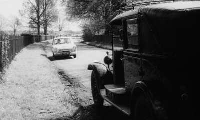
Romney Lock RoadIn 1962 access to Romney Lock was from here at the junction with Edward VII Avenue (Datchet Road), and down Romney Lock Road alongside the railway and then crossing the track by the lock cut at a level crossing which has now been replaced by a footbridge across the railway. Vehicular access to Romney Lock is now on the other side of the Riverside Station from Farm Yard. |
 During the chase scenes the robbers are pursued along King Edward VII Avenue and are seen here turning right from the Datchet direction into Romney Lock Road... |
|
Romney Lock Road would have formed part of the route around the 'Little Park' (as the Home Park was once known) from Windsor to Datchet, the other route being on the far side of the Castle and across what is now the private grounds of the castle. These routes were closed off when the Victoria and Albert Bridges were completed in 1851. The public area now known as the Home Park was once private and enclosed by high walls. In the early 1700s it was part of a plan by Queen Anne to create the Maastricht Lake and Gardens. See The Home Park |
 ...which turns out to be a dead-end! |
|
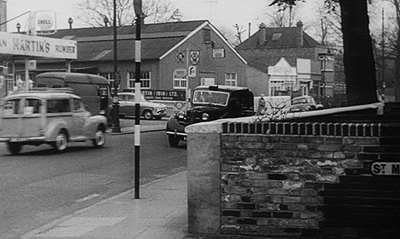
St Leonards RoadMartin's Garage was demolished to make way for Lammas Court. To the right, the Working Men's Club remains as of 2005, but the Spot Cafe and the house beyond (owned by Hulls the blacksmiths, with premises beside Bachelors Acre) were demolished to make way for flats in the 1990s. |
 |
|
 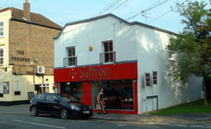 |
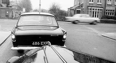
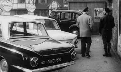
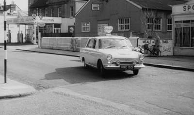
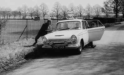
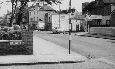 Another view of Martin's Garage. Note the Cedar Tree opposite, to the left of this view, a famous landmark in this part of Windsor. Beyond Martin's Garage is a smaller building used as a hairdressers, computer supplies shop and Office Services during the 1990s. In the early 2000s it became a restaurant, 'Saffron'. The Trooper Public House is beyond. Although the road in the foreground is named Rigby Road, this was only for the film, the actual road being Queen's Road. During the robbers get-away, the 'Glam Cabs' Cortina is seen passing Martins Garage and the famous Cedar Tree... |
|
Another view of the Working men's Club with a glimpse of the original Spot Cafe to the right. |
 |
St Marks Road
St Marks Road is little changed although the fireman's tower has since been removed when the new fire station came into use lower down St Marks Road. |
 |
|
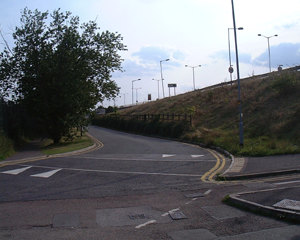
Stovell RoadStovell Road was lost beneath the Relief Road in the late 1960s. This view is at the junction with Maidenhead Road. To the right are the playing fields, Stovell Recreation Ground, now absorbed into the grounds of Windsor Boys School. The school lost much of its playing fields when the Relief Road (Royal Windsor Way) was constructed and although Stovell Recreation Ground had been Public Open Space, it is now fenced off and unavailable for public use, a fact that irritated some residents at the time. |
 |
|
The Relief Road now passes over the original Stovell Road, this being the realigned road through to Maidenhead Road. |
 Another view of Stovell Road from the north looking south towards Maidenhead Road. Note that the original Stovell Road ran directly under the present Relief Road. |
|
 An underpass constructed through to Clewer, the entrance to which is on the right of this view. |
 A similar view of the original Stovell Road looking south and slightly east towards Maidenhead Road and Windsor Boys School (known as Windsor Grammar School in 1962). |
To contact us, email Thamesweb. |
||||||