Windsor Castle and River
Thames in the 1830s
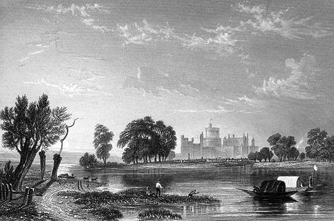
This engraving was probably
created in the 1830s. The original was drawn by G F Sargent and
engraved by J C Varrell for inclusion in an edition of Shakespeare's
Merry Wives of Windsor. The view is from the west, north of the
river, approximately at the point where the Relief Road, the
Windsor bypass, crosses the river at Elizabeth Bridge. The river
bank below and on the right side of the castle seems to break
by four trees which could be the backwater now known as Baths
Island. The railway line which now crosses the river on its way
to Windsor Central Station was not to be built until 1849.
The major features of the view are: The boats, foreground
right, are probably eeling boats, with a light hanging to attract
the fish at night. The castle itself is romantically drawn, with
its elevation exaggerated. The Round Tower as illustrated, and
which remains the same to this day, was raised in height in 1828
during the extensions and renovations undertaken by Sir Jeffry
Wyatville, architect, at that time. On the far right of the castle
is a tower, rebuilt in the 1850s, and now known as the Curfew Tower, with its famous Pepper Pot roof
line. In this engraving, the earlier tower is evident.
Windsor Castle from the
west in the 1830s
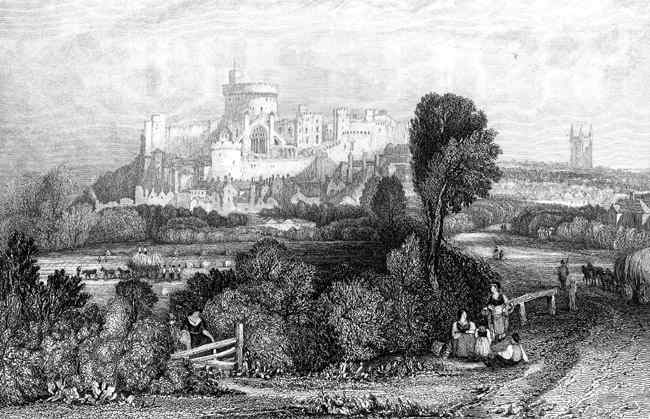
This view is particularly
interesting as it does NOT feature the river in the foreground!
Nearly every artist or engraver who pictured Windsor in past
times could not resist including the river, yet here the artist
is concentrating on the rural nature of the scene to the west
of the town. The lane illustrated runs westward from Windsor
and at the time of the engraving was known as Clewer Lane, following
the line of what is now known as Oxford Road although much of
this road has since disappeared, covered by the 1960s construction
of Ward Royal.
A short length remains at the junction with Peascod Street, (Oxford
Road East).
To the west of Ward Royal, the original road remains from
Alma Road to Vansittart Road. Old maps show that this road, originally
Clewer Lane, dog-legged right and immediately left again, past
Clewer
St Stephens, to
follow the route now known as Maidenhead Road which continued
to the west past Clewer village. This section was known as Clewer
Road in the late 1800s.

To contact us,
email Thamesweb.
|